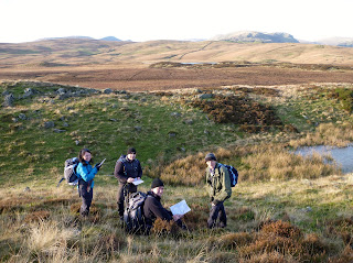
The next available weekend course is May 25th & 26th 2013 and the cost for the two day Navigation Course is only £80 per person for the weekend. We currently have eight places available.
The price includes the provision of laminated maps for the areas to be covered in both 1:25 and 1:50,000 scales. You will need to provide your own compass for the course and we would recommend the Silva Type 4 Expedition compass for this Navigation Skills training Course.
These Navigation skills training course are ideal for anyone wishing to improve their map reading & navigation skills to allow them to venture into mountainous regions of the UK with confidence.
Some previous experience of map reading & navigation techniques is useful but not essential.
These courses are also ideal if you are preparing for your Summer Mountainwalking Leader Assessment either as preparation for the assessment or as a Mountainwalking Leader Refresher course prior to attending a reassessment for your Summer Mountainwalking Leader Award.
Map reading & navigation skills form the backbone of every Mountainwalking Leader Assessment whether it be summer or winter, so confidence with this skill is essential to pass the award.
The course itinerary
We will meet on both days at 09:00 at Wilf's Cafe at Staveley Mill Yard in Staveley (LA8 9LR for those of you with Satnav). On day one we will travel to the nearby area of Green Quarter Fell to introduce basic map reading & navigation techniques providing a progression throughout the day for everyone - no matter what level of expertise you have.
Day one is designed to be an informal introduction to the basics skills needed to map read in the mountains - building on the skills you already possess and adding more! The whole course wil take place in a relaxed atmosphere - it is meant to be fun!
 On day two, we travel further up the Kentmere Valley to walk part of the Kentmere Horseshoe and here we can consolidate the skills taught on day one as well as adding techniques not already covered.
Here, walking at a higher altitude, we are more likely to encounter the conditions which will test your ability. Low cloud, poor visibility and strongers winds. All these things go together to make a realistic environment in which to test your skills in preparation for going into the mountains on your own or with friends
The following aspects of navigation skills will be covered during the course :-
Orientation of the map,
Grid references,
Measuring distance on the map & on the ground by pacing.
Tick off features,
Naismiths rule (timings c/w distance & contours),
Taking & walking on a bearing using a map, ie grid to mag,
Identifying from ground to map (Mag to grid),
Walking on a bearing/back bearings,
"Handrailing" using Linear features (eg streams/footpaths),
Aiming off,
Attack points,
Resections,
"Boxing" around an obstacle.
The emphasis throughout the course is to give you as many opportunities as possible to progress to a high standard of mountain navigational capability. We run all of our Navigation Skills Training courses to Mountain Leader Training (MTE) Standard.
We are also running these Mountain Navigation Skills Training Courses during Autumn & Winter 2013 during the following dates:-
September 28/29 and October 26/27 (10 places available each course)
November 9/10 and November 30 / December 1 (10 places available each course)
Please get in touch with your queries either by phoning Iain on 07761 483364 or by using the contact us form on the website and we will be happy to answer any questions and to take your booking.


No comments:
Post a Comment